
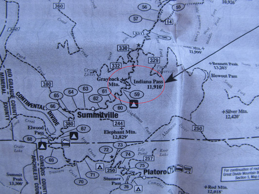
Indiana Pass
|
Indiana Pass |
Indiana Pass - Rio Grande County - Colorado - 11,958 feet
East Fork Pińos Creek to northeast. Wightman Fork Alamosa River to south.
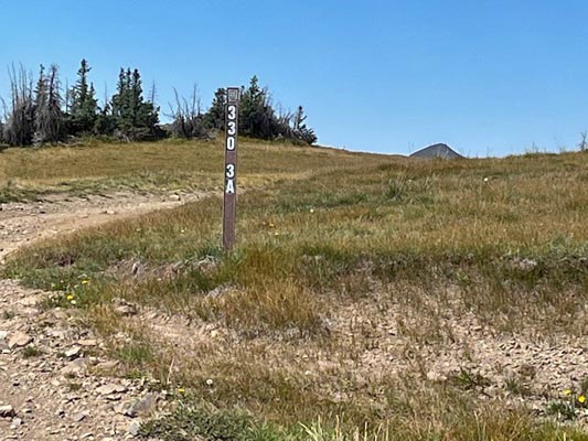
On FR-330 (Summitville Rd) south of South Fork and northeast of Summitville.
gravel, dirt - dual sport
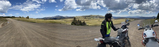
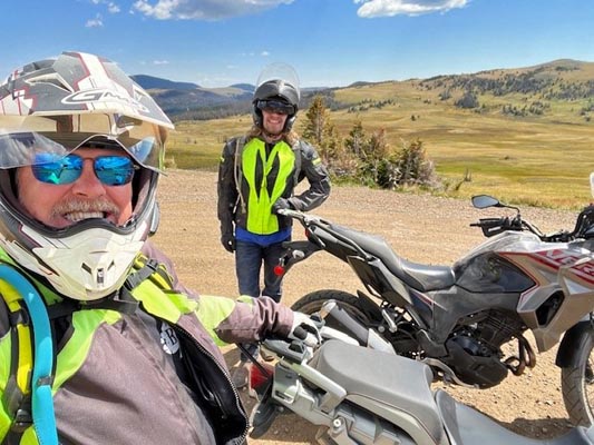
photos by Scott Westfall, 9/7/2022
Crest of FR-330 looking east towards Bonito Mountain. |
Crest of FR-330. |
Crest of FR-330 looking west towards Grayback Mountain. |
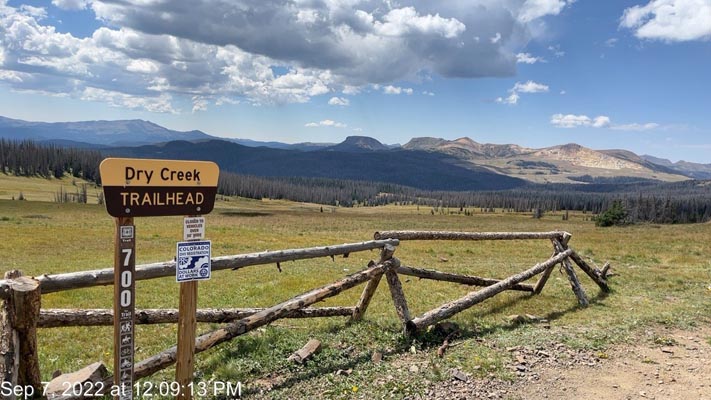
Junction of FR-330 and FT-700 looking south. |
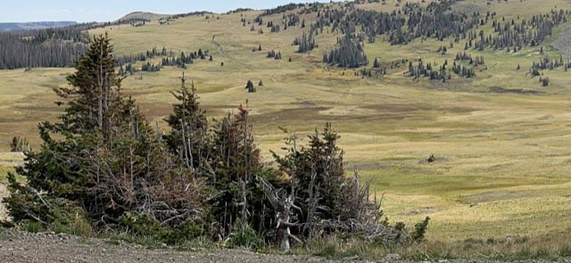
Geographic highpoint of the saddle, identified as dark patches just above and to the right of foreground trees. FT-700 visible on the right. |

Google Maps |
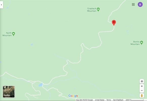
Google Maps |
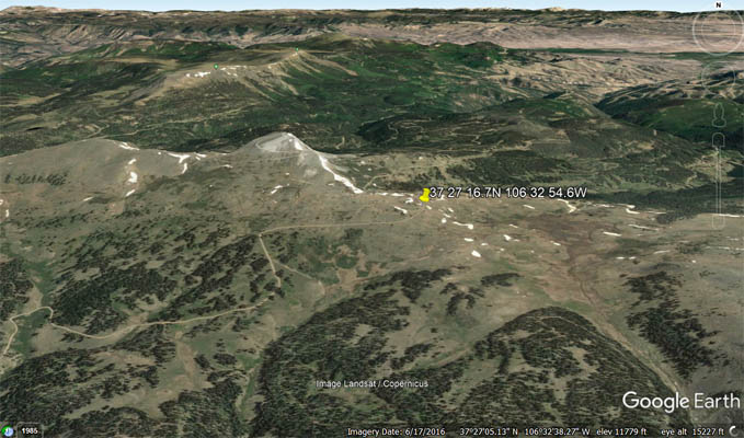
Google Earth |

Google Earth |
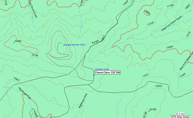
Garmin MapSource |
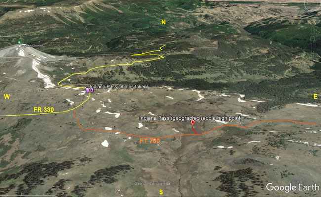
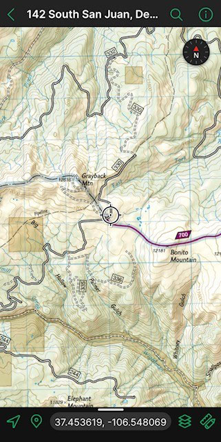
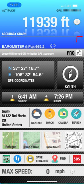
Google Earth. 106.541W at 11,732' elevation. This area can be seen in satellite photos as a group of small alpine ponds about 1/2 mile east of the junction of FR-330 and Forest Trail-700, and 250 feet north of the dual-track trail itself as it heads due east towards Bonito Mountain from the road. |
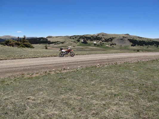
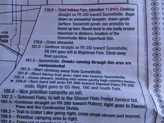
Indiana Pass--as it lies on FR-330--can be accessed easily via standard 2-wheel drive passenger car from the north side. The northern portion of FR-330 is smoother than the southern, which is odd considering the MVUM shows the opposite. |
At the summit. |
Notes from Scott: Indiana Pass is located in Rio Grande County, Colorado, in the Rio Grande National Forest. While the road crest of
FR-330 as it traverses the east face of Grayback Mountain is most commonly recognized as Indiana Pass at 11,958' elevation, geographic
analysis of the area shows the high point of a saddle between the watersheds of East Fork Pińos Creek (north) and Wightman Fork Alamosa
River (south) occurring at 37.4522N 106.541W at 11,732' elevation. This area can be seen in satellite photos as a group of small alpine
ponds about 1/2 mile east of the junction of FR-330 and Forest Trail-700, and 250 feet north of the dual-track trail itself as it heads
due east towards Bonito Mountain from the road.
Final assessment from Scott: Easy dirt ride with great scenery, historical mining settlements and wide picturesque views.
Two-up loaded heavy street bike or ADV no problem for all but the most novice riders. Only bumps are on the south end of FR-330 near
the mine. No notable hazards, water crossings, steep grades or obstacles. Multiple approaches from the north (FR-345/360/380 from
South Fork, CR-14/FR-345 from Del Norte), east (CR-12S/FR-250 from Monte Vista), west (667 from US-160), or south (FR-250 from CO-17
at McIntyre Peak) with similar quality forest roads.
photos by Curtis Kohl, 5/27/2011

At the summit. |
At the summit. |
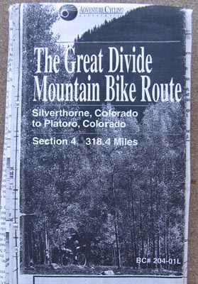
Adv Cycling |
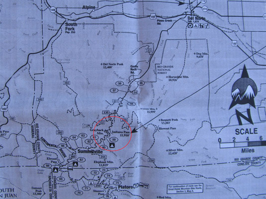
Adv Cycling |
Adv Cycling |
Adv Cycling |
| Feature Name | ID | Class | County | State | Latitude | Longitude | Ele(ft) | Map | BGN Date | Entry Date |
| East Fork Pinos Creek | 190588 | Stream | Rio Grande | CO | 373347N | 1062903W | 8779 | Horseshoe Mountain | - | 13-OCT-1978 |
| Wightman Fork | 190605 | Stream | Rio Grande | CO | 372415N | 1063116W | 9393 | Summitville | - | 13-OCT-1978 |
| Grayback Mountain | 190621 | Summit | Rio Grande | CO | 372742N | 1063326W | 12605 | Summitville | 13-OCT-1978 | 06-FEB-2019 |