Squaw Pass
|
Squaw Pass |
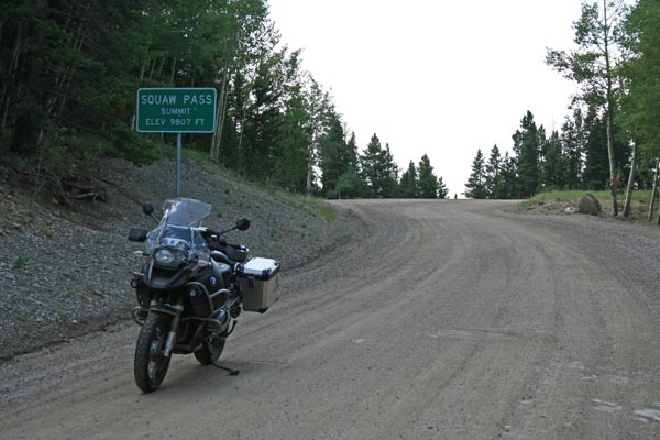
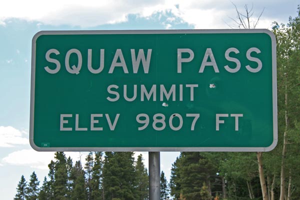
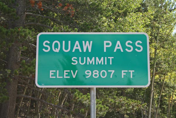
Squaw Pass - Clear Creek County - Colorado - 9,807 feet
(other names - Soda Creek, Soda Hill)
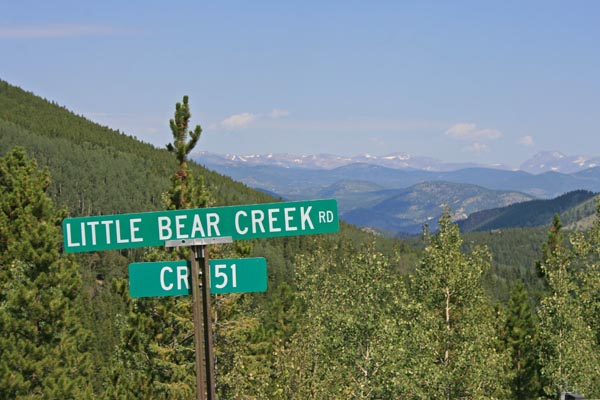
Little Bear Creek to north. Corral Creek to south.
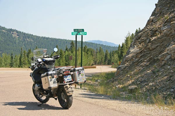
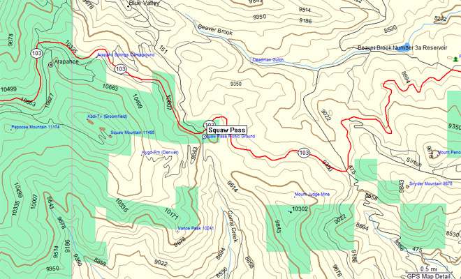
CO-103 west of Bergen Park
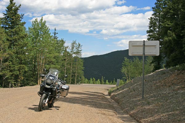
Ridge line - CO-103, pavement - road bike
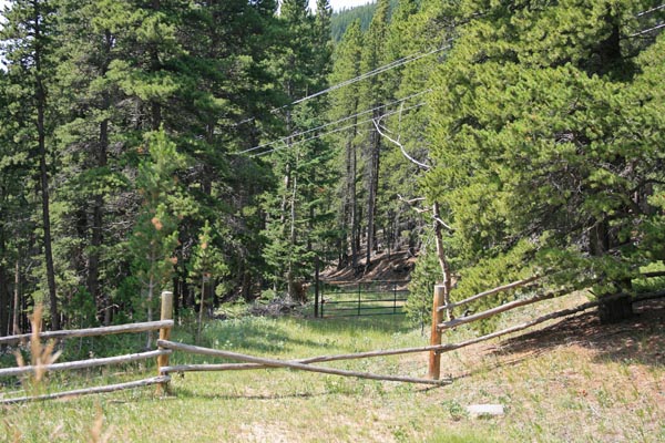
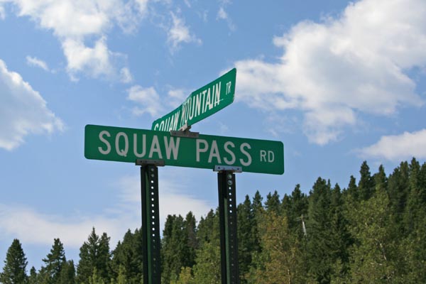
The old pass road - CR-151 (Little Bear Creek Rd, leads to Idaho Springs) to north, Squaw Mountain Tr (leads to a subdivision) to south - gravel - dual sport
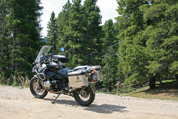
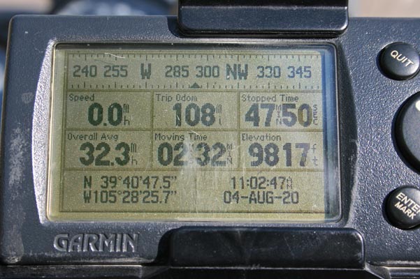
photos by Randy Bishop, 8/4/2020
At the summit, looking south. |

At the top of the hill. |
At the top of the hill, looking south. |
Looking south down the old pass road. |
At CO-103. |
At CO-103, looking east. |
On south side of CO-103. |
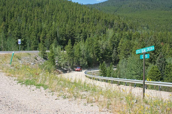
Looking northwest down CR-151, the old pass road. |
On north side of CO-103. |
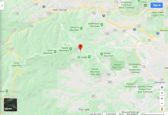
Google Maps |
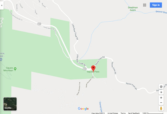
Google Maps |
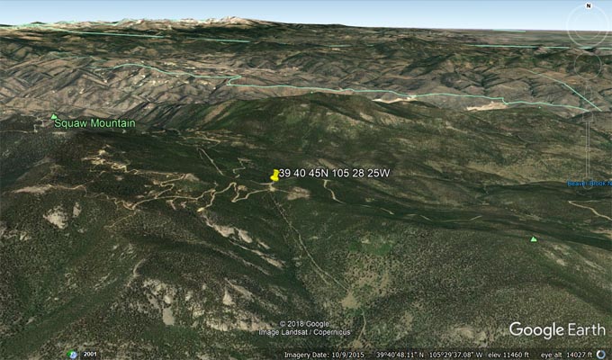
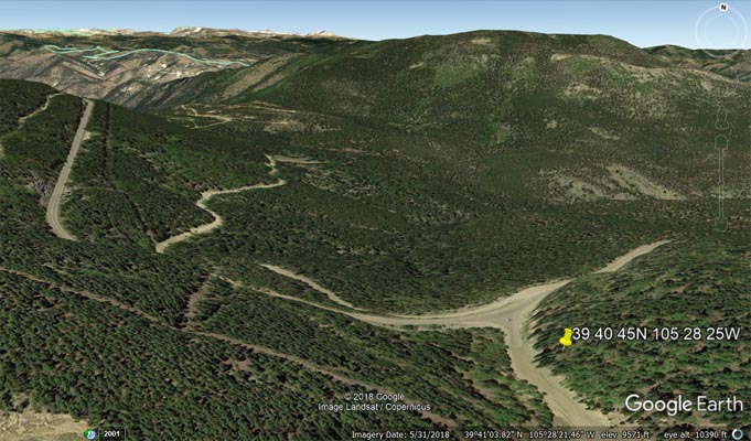
Google Earth |
Google Earth |
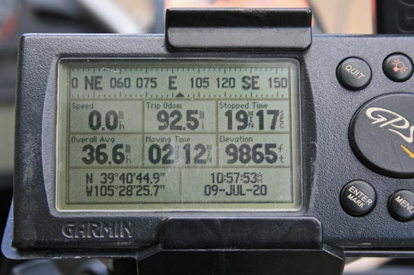
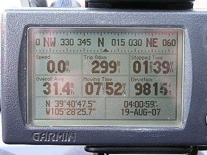
Garmin MapSource |
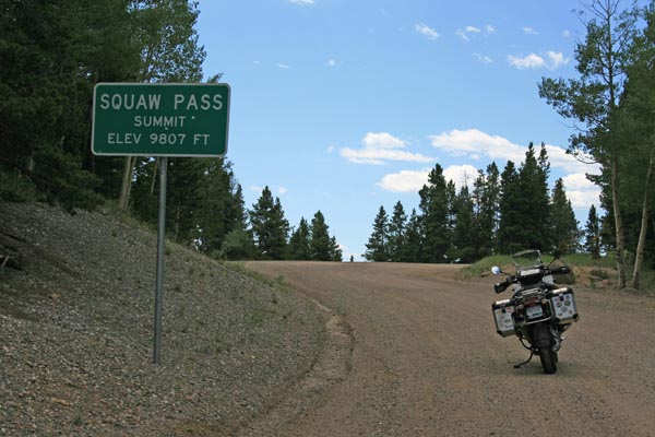
photos by Randy Bishop, 7/9/2020
At the summit. |
At the summit, looking north. |
At the summit, looking south. |
At the summit. |
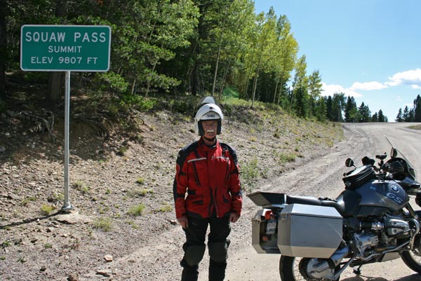
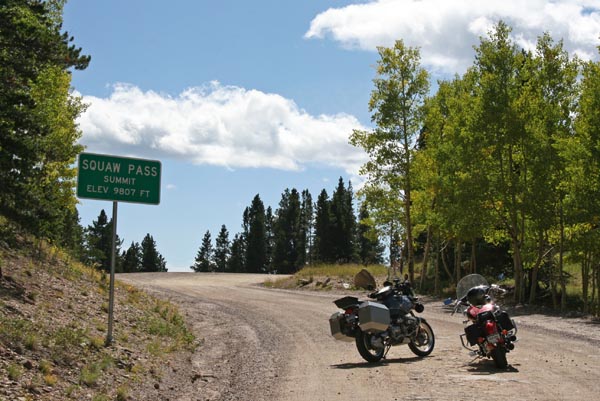
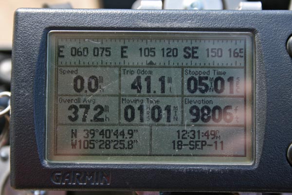
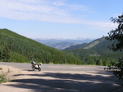
photos by Randy Bishop, 9/18/2011
At the summit. |
At the summit. |
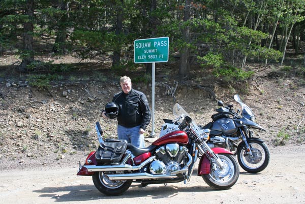
At the summit. |
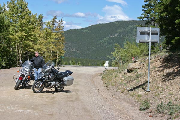
At the summit, looking north. |
At the summit, looking south. |
At the summit. |
#21 - photos by Randy Bishop, 7/30/2005

East of the summit. |
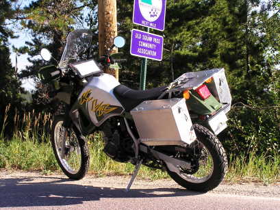
East of the summit. |
At the summit, looking north. |
At the summit. |
| Feature Name | ID | Class | County | State | Latitude | Longitude | Ele(ft) | Map | BGN Date | Entry Date |
| Squaw Pass | 204711 | Gap | Clear Creek | CO | 394045N | 1052825W | 9810 | Squaw Pass | - | 13-OCT-1978 |
| Feature Name | ID | Class | County | State | Latitude | Longitude | Ele(ft) | Map | BGN Date | Entry Date |
| Little Bear Creek | 181946 | Stream | Clear Creek | CO | 394339N | 1053103W | 7838 | Idaho Springs | - | 13-OCT-1978 |
| Corral Creek | 182047 | Stream | Clear Creek | CO | 393738N | 1052538W | 7543 | Squaw Pass | 13-OCT-1978 | 31-OCT-2019 |
| Chief Mountain | 181964 | Summit | Clear Creek | CO | 394033N | 1053122W | 11712 | Idaho Springs | 13-OCT-1978 | 29-JUN-2019 |
| Papoose Mountain | 181963 | Summit | Clear Creek | CO | 394048N | 1053047W | 11155 | Idaho Springs | 13-OCT-1978 | 29-JUN-2019 |
| Squaw Mountain | 182066 | Summit | Clear Creek | CO | 394045N | 1052934W | 11843 | Squaw Pass | 13-OCT-1978 | 29-JUN-2019 |